
<< back to Spatial Data Collection
The Open Data Collection can only be accessed in the DREAM Lab. Feel free to come by and explore what we have on our computers! Instructions on how to find spatial data in the Library catalog can be found here. The Open Data Collection folder contains electronic information resources that are in the Public Domain or are otherwise available to be freely redistributed. You may do what you wish with this data.
If you are unable to visit the Library, please email us a dreamlab@library.ucsb.edu to discuss access to our DREAM Lab-only resources.
Resources include business, social science, demographic, and spatial data. The resources are organized into 4 folders:
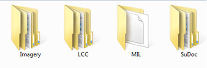 *Screenshot of folders
-
Imagery: Raster data ready for use in a GIS. Organized by folders named with the originator of the imagery. This folder hierarchy includes historic aerial photographs that have been georeferenced by the Library or research partners.
- LCC: Library of Congress Classification. These are primarily maps that have been scanned from books.
- Highlight: an extremely large, detailed image of Kanos, Nigeria from 1970
- Highlight: an extremely large, detailed image of Kanos, Nigeria from 1970
- MIL: MIL Classification (follow link to call number guide). 450 titles of vector and raster geospatial data and scanned maps organized according to our in-house call number scheme. Plus disk images pulled off of legacy media from the 1970s through early 2000s.
- Highlights: Santa Barbara, Ventura, and San Luis Obisbo Counties government data
- Highlights: Santa Barbara, Ventura, and San Luis Obisbo Counties government data
- SuDoc: Federal Depository call numbers. These materials are federal reports and publications either deposited to UCSB or captured from the web. Primarily USGS PDF's of local interest.
The MIL directories contain 450 titles of scanned maps and geospatial data. Not all of these folders are described in the Library Catalog.
- Don't forget: we also have a giant CD-ROM collection.
