
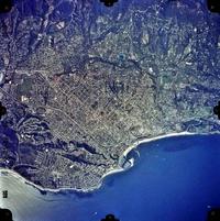
Medium Resolution Satellite Imagery
| Full-scene | Detail of portion of full-scene |
|---|---|
|
|
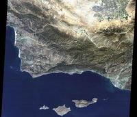
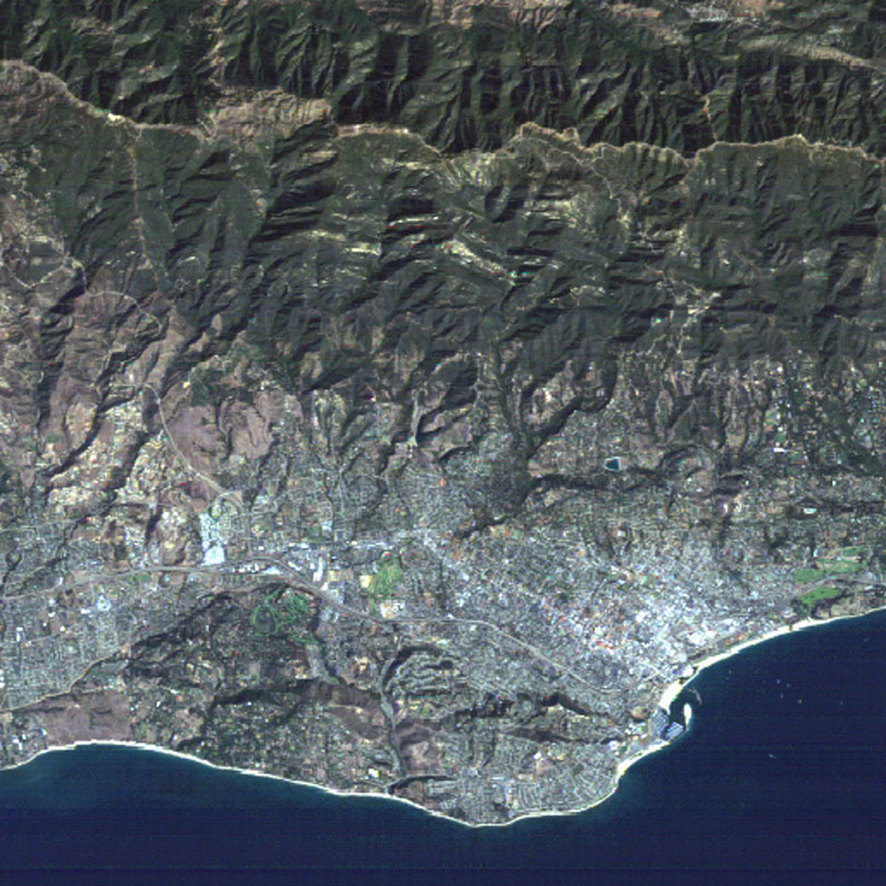
Characteristics of medium resolution satellite imagery
- Date of image: October 20, 1993
- Spatial resolution: 30 meters
- Smallest resolvable object: ~75 meters
- Source: digital data collected in 7 spectral bands (3 visible, 3 infrared, 1 thermal infrared) by CCD on satellite (Landsat)
- Access: EOSAT, EROS Data Center, Space Imaging Corp.
- Uses: land cover and land use analysis and classification, change detection, crop yields, soil surveys, geological investigations and geomorphological mapping, forest inventory, hydrologic studies, water quality monitoring, and oceanography
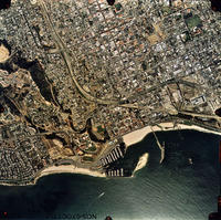
Small Scale Aerial Photograph
| Full-scene | Detail of portion of full-scene |
|---|---|
|
 View full resolution image View full resolution image
|
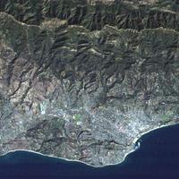
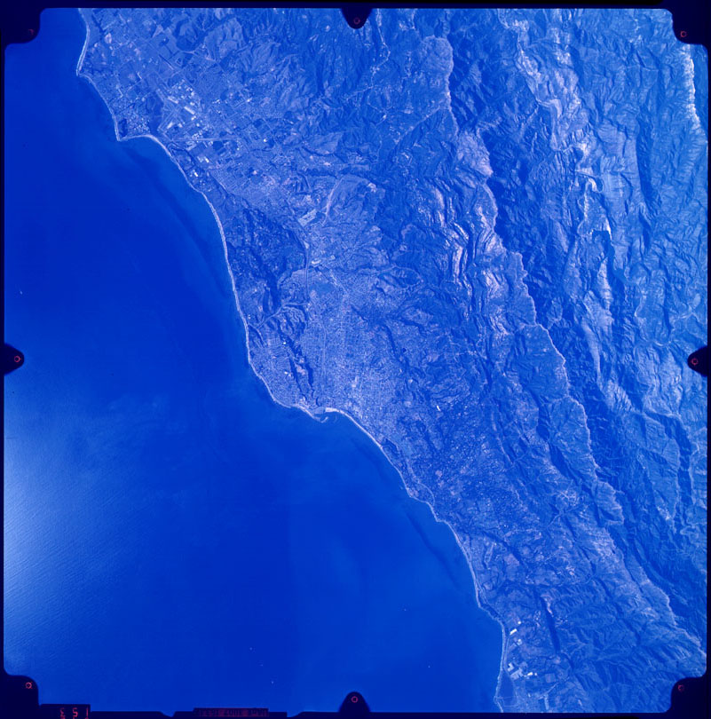
Characteristics of small scale aerial photograph
- Date of photograph: December 13, 1974
- Scale: 1:130,000
- Smallest resolvable object: 10 meters
- Source: color photographic film/camera in high-altitude aircraft
- Access: NASA
- Uses: mapping and monitoring in the fields of agriculture, forestry, geology, geomorphology, hydrology, oceanography, and urban development and planning
- Specific use of illustrated flight: oil seepage detection
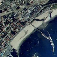
Medium Scale Aerial Photograph
| Full-scene | Detail of portion of full-scene |
|---|---|
|
|
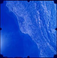
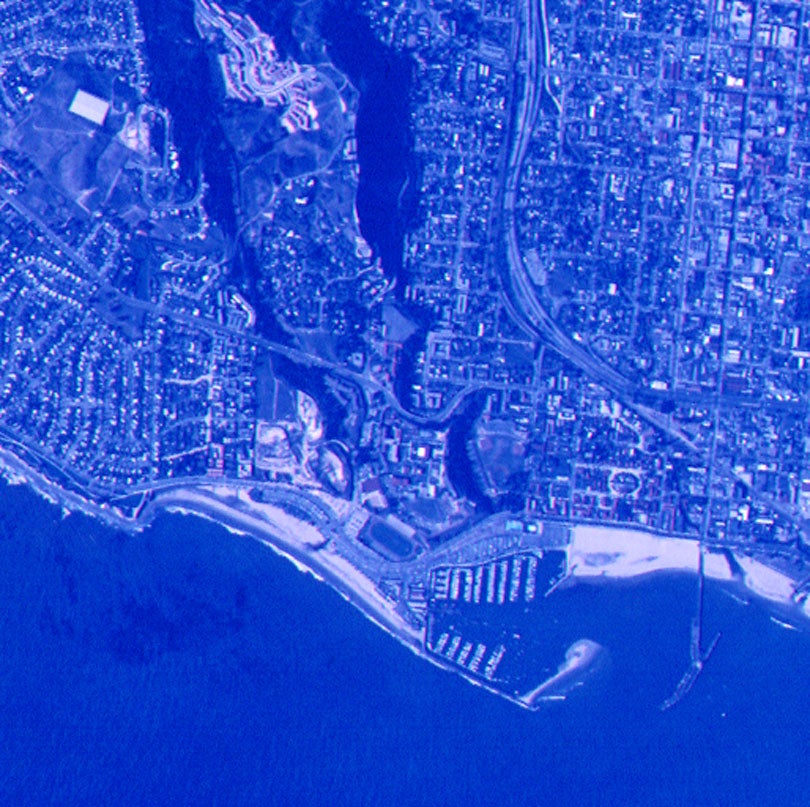
Characteristics of medium scale aerial photograph
- Date of photograph: March 21, 1982
- Scale: 1:42,000
- Smallest resolvable object: 5 meters
- Source: color photographic film/camera in aircraft
- Access: National Ocean Service
- Uses: mapping and monitoring in the fields of agriculture, forestry, geology, geomorphology, hydrology, oceanography, and urban development and planning
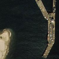
Large Scale Aerial Photograph
| Full-scene | Detail of portion of full-scene |
|---|---|
 View full resolution image View full resolution image
|
 View full resolution image View full resolution image
|
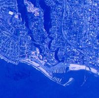
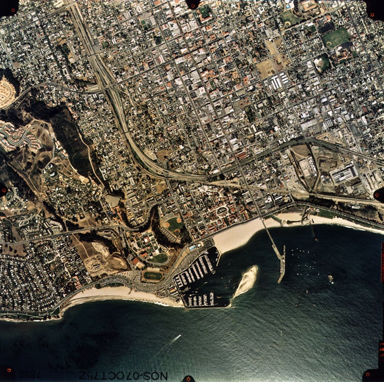
Characteristics of large scale aerial photograph
- Date of photograph: October 7, 1975
- Scale: 1:15,000
- Smallest resolvable object: 1 meter
- Source: color photographic film/camera in aircraft
- Access: National Ocean Service
- Uses: mapping and monitoring in the fields of agriculture, forestry, geology, geomorphology, hydrology, oceanography, and urban development and planning
