- Mon, 01/05/2026 - 8:00am to Fri, 12/11/2026 - 4:00pm
Exhibition
Since 2007, UCSB Reads has fostered a shared sense of belonging by bringing the UCSB campus and Santa Barbara communities together to read a common book that explores compelling issues of our time. Conceived by then Executive Vice Chancellor Gene Lucas, the program is led by the UCSB Library in...
More- Wed, 01/07/2026 - 4:00pm to 5:00pm
Event
Register Now
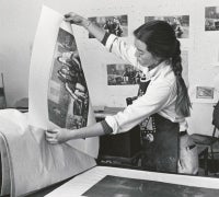
UC Santa Barbara Library invites you to a reception celebrating the new exhibition Elena Yu: Weaving Ephemera – 30 Years of the Ethnic...
More- Tue, 01/13/2026 - 1:00pm to 3:00pm
Event
UCSB students: Kick off UCSB Reads 2026 by getting your free copy of this year's book selection, Crying in H Mart by Michelle Zauner, while supplies last. Join your fellow Gauchos for this lively giveaway event in the Library's...
More- Tue, 01/20/2026 - 5:00pm to 6:30pm
Event
Location: Student Resource Building (SRB) MPR
Register Now
In Crying in H Mart, author Michelle Zauner...
More- Tue, 01/27/2026 - 5:00pm to 6:30pm
Event
Location: Student Resource Building (SRB) MPR
Register Now
Join Health & Wellness in collaboration with UCSB Reads,...
More- Mon, 02/09/2026 - 9:00am to Sat, 06/13/2026 - 4:00pm
Exhibition
More than 1,200 UCSB students annually participate in the UCSB Education Abroad Program (EAP) to study, intern, and conduct research in 35+ countries, earning UC credit toward majors, minors, and general education requirements. Returning students are invited...
More- Fri, 03/13/2026 - 11:00am to 2:00pm
Event
Take a healthy study break before finals. Stretch, color, grab snacks, and pick up free bluebooks and scantrons. Sign-up for a massage (first-come, first-served, in person, starting at 10:30 AM).
In collaboration with UCSB Health & Wellness and...
More- Thu, 05/07/2026 - 7:30pm
Event
Register Now
More“Michelle Zauner has written a book you experience with all of your senses: sentences you can taste, paragraphs that sound like music. She seamlessly blends stories of...
- Wed, 05/27/2026 - 4:00pm to 5:00pm
Event
Please join us for a reception and awards ceremony honoring the recipients of the 2026 Library Award for Undergraduate Research. Prizes of $750 for first place and $500 for second place will be awarded in each of three categories: Sciences & Engineering, Humanities & Fine Arts, and...
More- Fri, 06/05/2026 - 11:00am to 2:00pm
Event
Take a healthy study break before finals. Stretch, color, grab snacks, and pick up free bluebooks and scantrons. Sign-up for a massage (first-come, first-served, in person, starting at 10:30 AM).
In collaboration with UCSB Health & Wellness and...
More


